What am I going to learn in Geography?
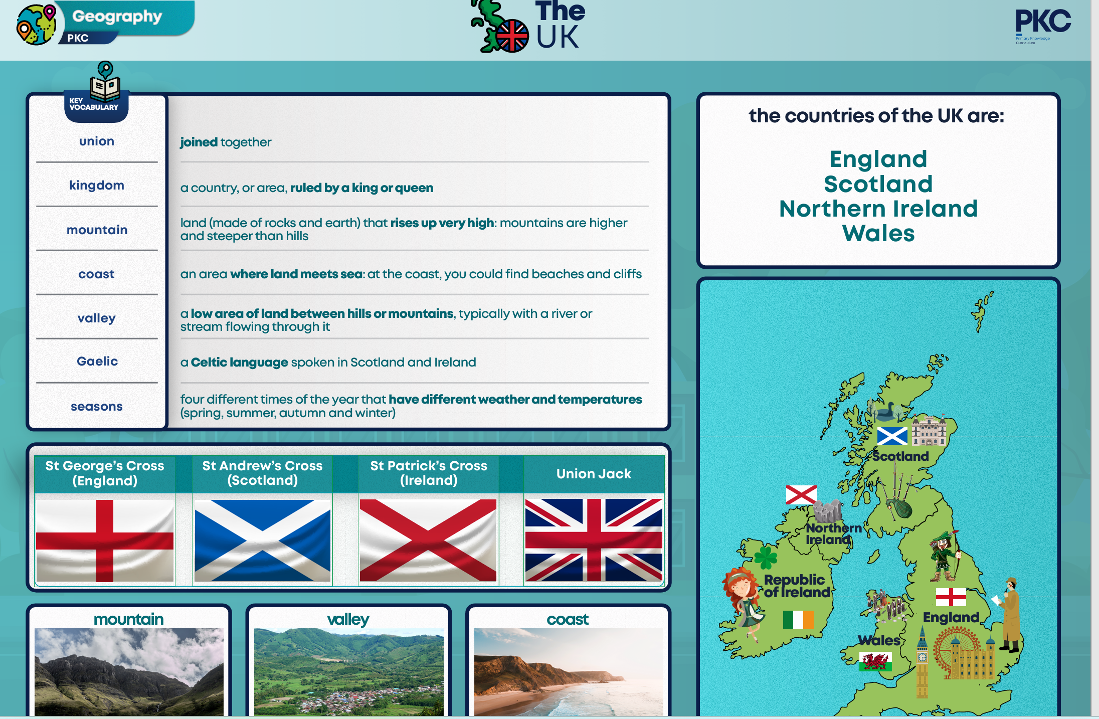
Year 1 – The UK
Children will use maps of the UK and will locate England, Scotland, Northern Ireland and Wales. They will learn to locate the countries of the United Kingdom, recognise their flags and name their capital cities. Throughout this unit, children will be forming an understanding that the United Kingdom is a diverse place, is home to contrasting landscapes including rural and urban environments. They will encounter new and ambitious vocabulary that features throughout the unit, offering children many opportunities to rehearse and apply it in their talk tasks and written work.
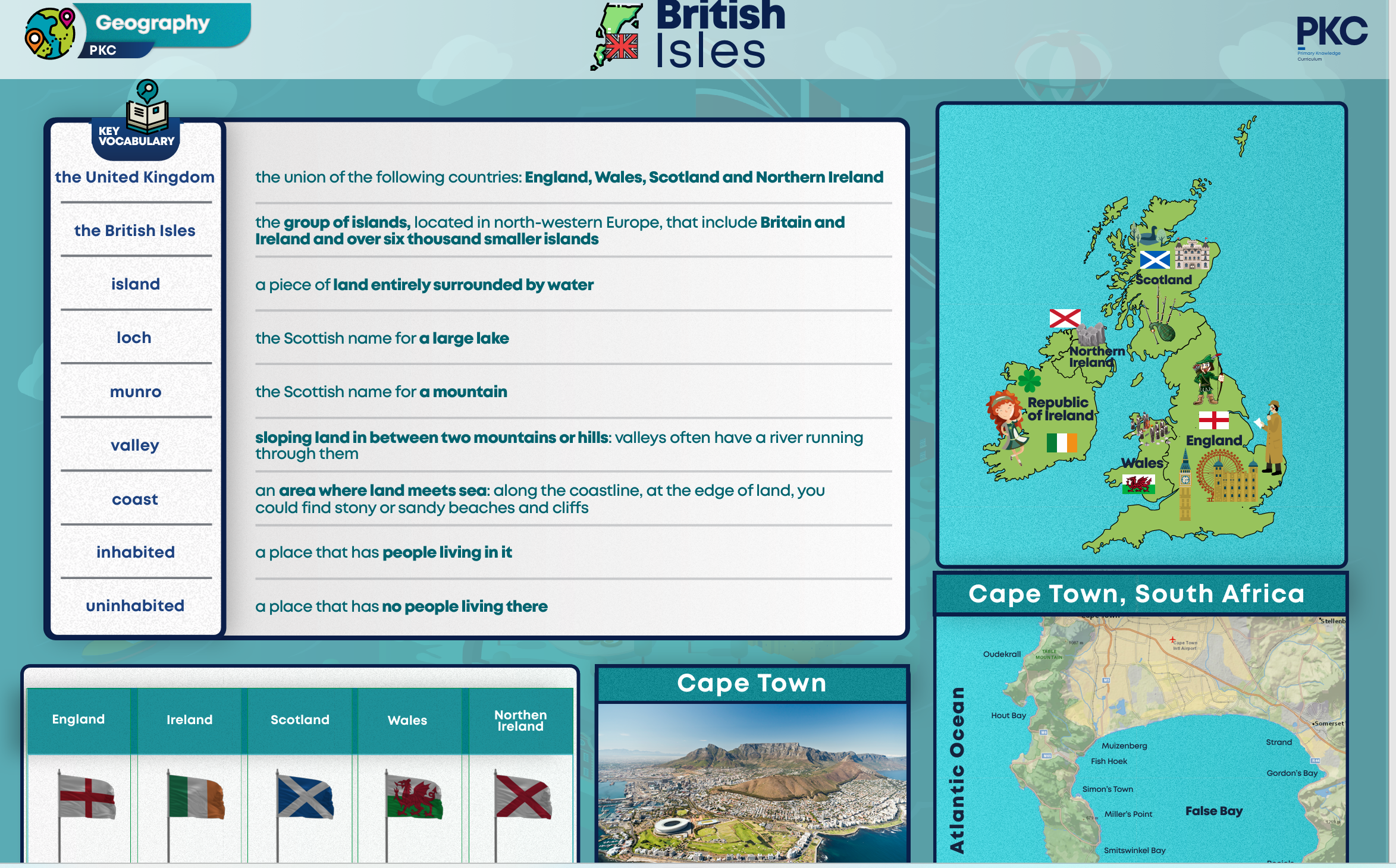
Year 2 – The British Isles
During this unit, children will have an opportunity to consolidate their understanding of the geography of the UK and should be able to use maps to identify the locations of the countries within the British Isles. As children journey through the curriculum, they will learn more and remember more about the British Isles as they study both local and UK geography units of work. Throughout this unit, children will look at the link between the geography of a place and its human features. They will learn about the countries of the British Isles, focusing on key terminology such as port, harbour, coastline, and island. They will become familiar with key geographical features of the British Isles, including mountains and valleys in Wales and The Giant’s Causeway in Northern Ireland.
![]()
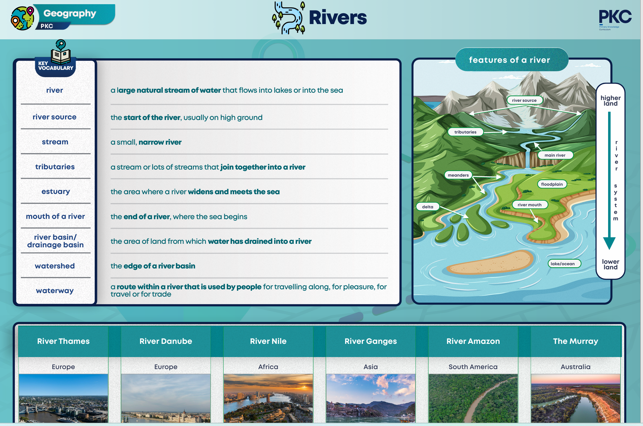
Year 3 – Rivers and the Water Cycle
In this unit, children will develop their understanding of how people interact with the world around them. They will explore how people use rivers, for example for irrigation for farmland, for transport and as a water supply. They will consider the impact of less than normal rainfall on rivers, specifically the Mississippi River, and then in turn the impact that a drought can have on the people who rely on the river. Children will be using maps, atlases, globes and digital/ computer mapping to locate the rivers, the countries they journey through and to describe their features, particularly their shape and direction of travel.
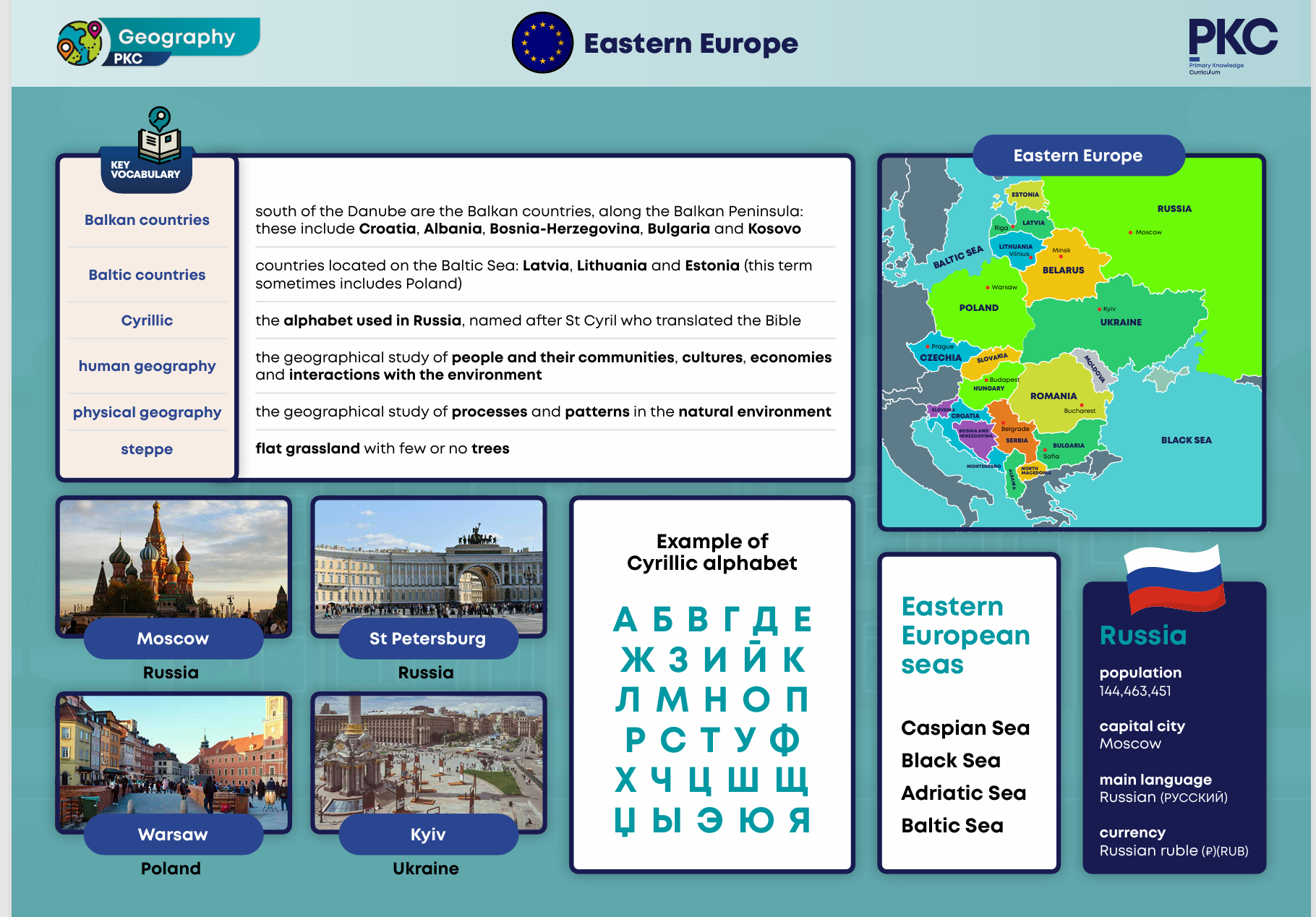
Year 4 – Eastern Europe, Migration and Trade
T. In this unit, children will build on their knowledge of Europe and explore Eastern Europe in more depth. They will explore the countries of Eastern Europe and key features such as rivers and climate. They will compare the UK with a chosen European country. This allows schools to make their own decisions on which country to study based on their school context. Children will then study the recent conflict in Ukraine and explore the impact on the rest of Europe. They will locate Crimea on a map of Eastern Europe and discuss why its geography has led to many different conflicts over time. Children will use maps and atlases to locate countries and features of Eastern Europe. They will use their prior knowledge of regions of Europe to identify countries. They will annotate blank maps and use atlases to find information.
![]()
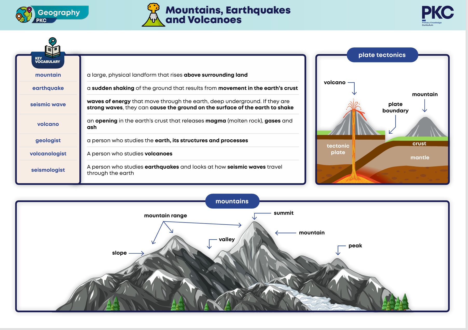
Year 5 – Mountains, Earthquakes and Volcanoes
This unit builds on children’s understanding of physical geography. It aims to introduce children to the physical processes involved with earthquakes and volcanoes. Children will learn that mountains are large landforms that rise above the surrounding land. The unit explores the formation of mountains. Children will use relief maps. They will identify the Alps, Caucasus and Ural Mountains. They will also identify the Andes in South America and the Rocky Mountains in North America. Children will build on their knowledge of mountains and study the Alps in more detail. Children will use atlases to locate the Alps and will learn they spread across several European countries, including France, Switzerland and Italy. They will learn about the discovery of a man in the Alps, who died over 5000 years ago, whose body had been preserved in ice. Children will study the cause and impact of earthquakes and volcanoes.
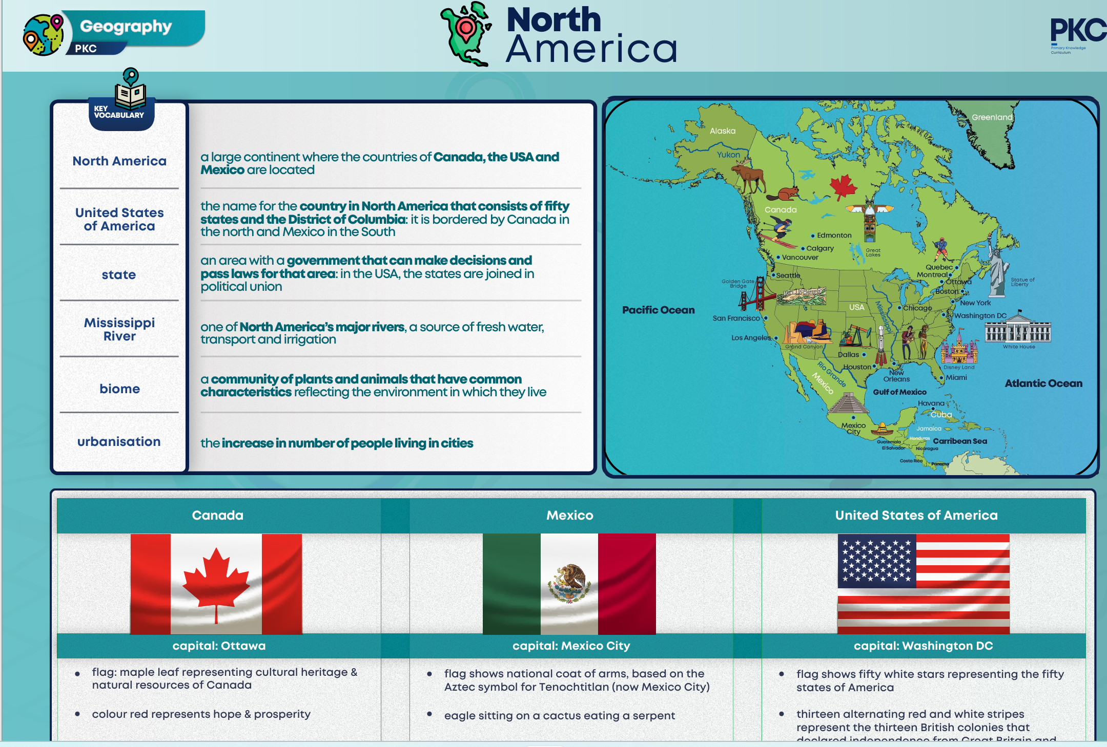
Year 6 – North American Geography
Children will identify the countries within this continent, including the United States of America, Canada and Mexico. Children will use atlases to identify locations in North America. They will locate the Bearing Sea and learn that it is thought that the ancestors of Native Americans travelled from Asia, across a bridge of land that is now under the Bering Sea, to begin populating the North American continent. Children’s understanding of biomes will be developed in this unit as they look at the tundra in the northern parts of the continent and the tropical forests of the southern parts of the continent. Children will build on their map skills as they explore maps of North America and develop their research skills using online map tools.
![]()